Last Updated on October 30, 2021 by Red Nomad OZ
Kangaroo Island Bushfires
Choking back tears, he told me “I looked out over the plain and howled. It’ll take a long time to recover, and it probably won’t be in my lifetime”.
I was talking to David, a now-retired guide who had spent 15 years conducting eco-tours in Flinders Chase National Park and the adjoining Ravine des Casoars Wilderness Protection Area on South Australia’s Kangaroo Island. He was telling me about his reaction to the horrific bushfires, started by lightning strikes, that burnt more than 46% of the island’s 440,500 hectares (1,700 square miles) over several weeks of the 2019/2020 Australian summer. Two lives and 50 houses were lost in the blaze, numerous farms and businesses ruined and thousands of animals—both livestock and wildlife—perished.
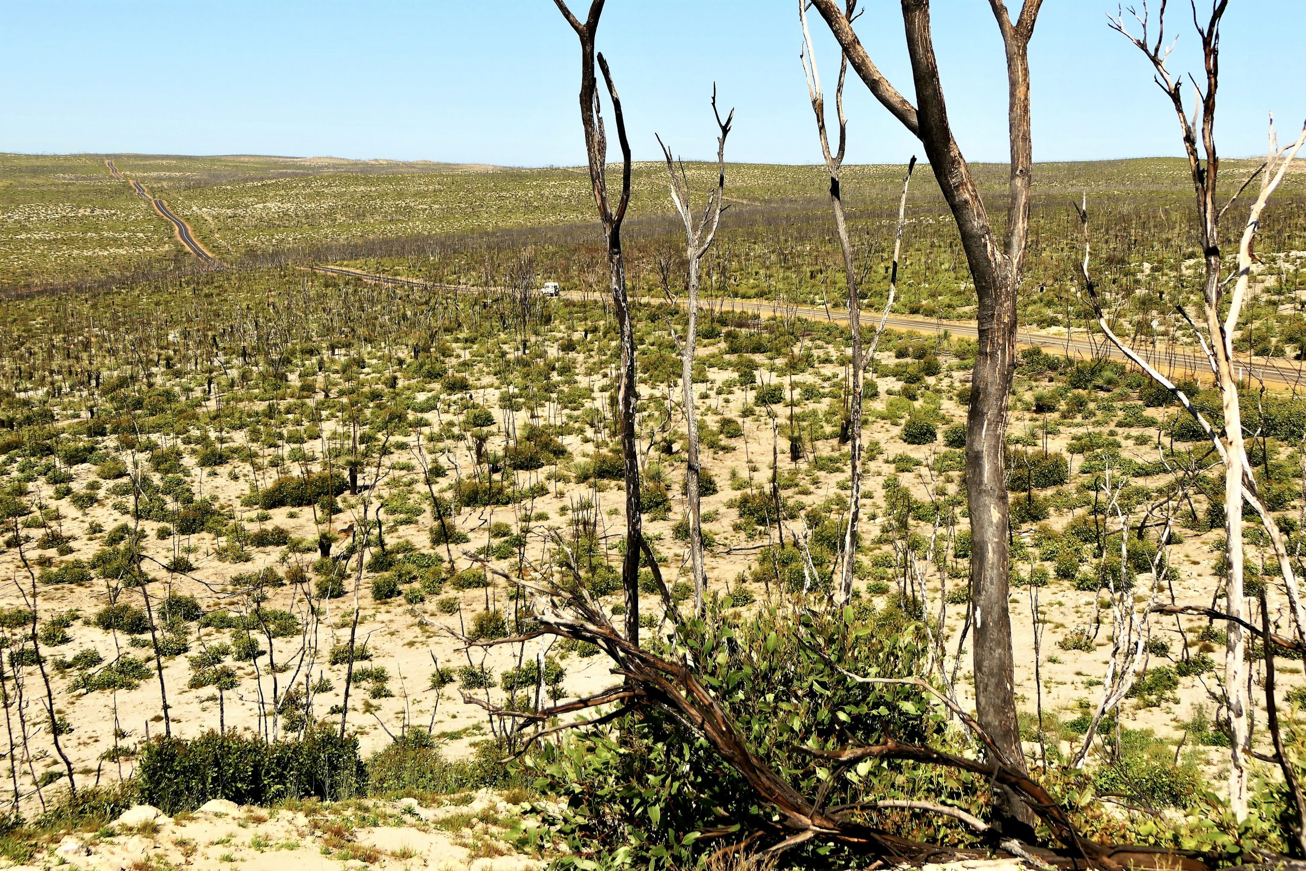
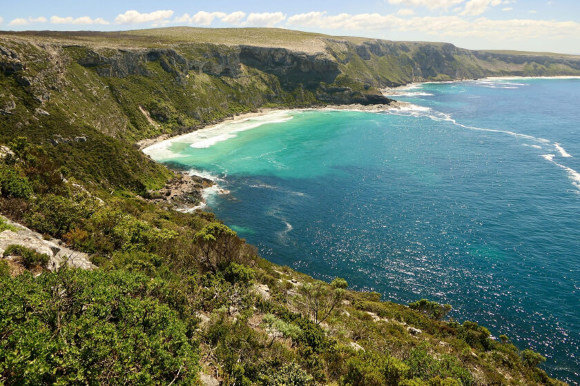
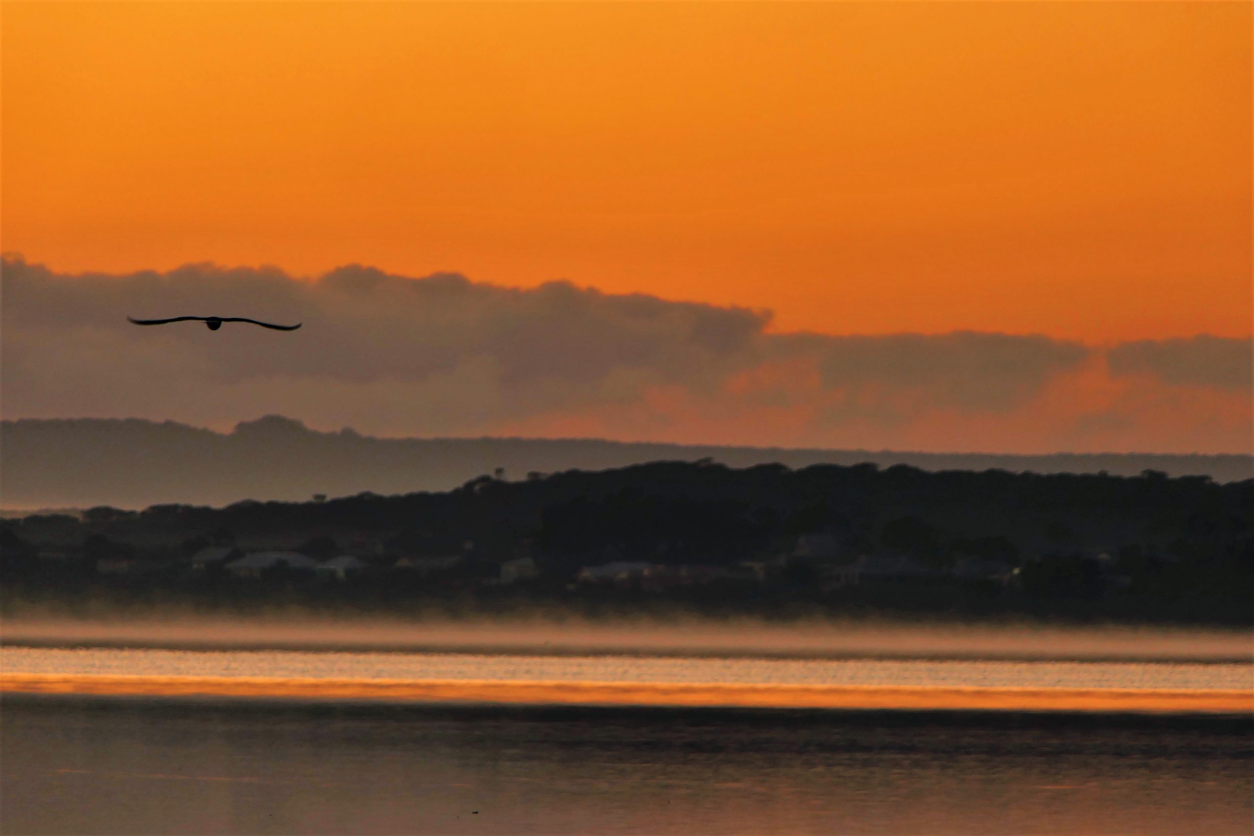
I knew what he meant. I had just seen the devastation he was describing for myself from the Bunker Hill observation point that looks out over the coastal plain. Over 72,000 hectares (278 square miles), or about 96% of the bushland in the park was destroyed by the fires, and it was a confronting sight.
Kangaroo Island Today
Once covered in lush eucalypt woodlands and dense coastal scrub, the rolling hills and plains were open and bare where the understory and low vegetation had been burnt away. In many places, only scorched tree trunks remained, very different to the verdant forests I remembered from my only other visit to Kangaroo Island 15 years earlier.

The bushfires have had devastating environmental, economic and personal consequences for Kangaroo Island’s 4,500-strong population, and have forever separated its history into “before” and “after” the blaze. Recovery on all fronts has been long, slow and hindered even further by COVID-19 restrictions.
Despite the extensive fire damage, it’s easy to see why the national park still attracts many of Kangaroo Island’s 140,000 annual visitors. Nearly ten months on, the bushland’s regeneration is well under way. A mantle of green is starting to cover the blackened ground and new growth sprouts from the burnt tree trunks.
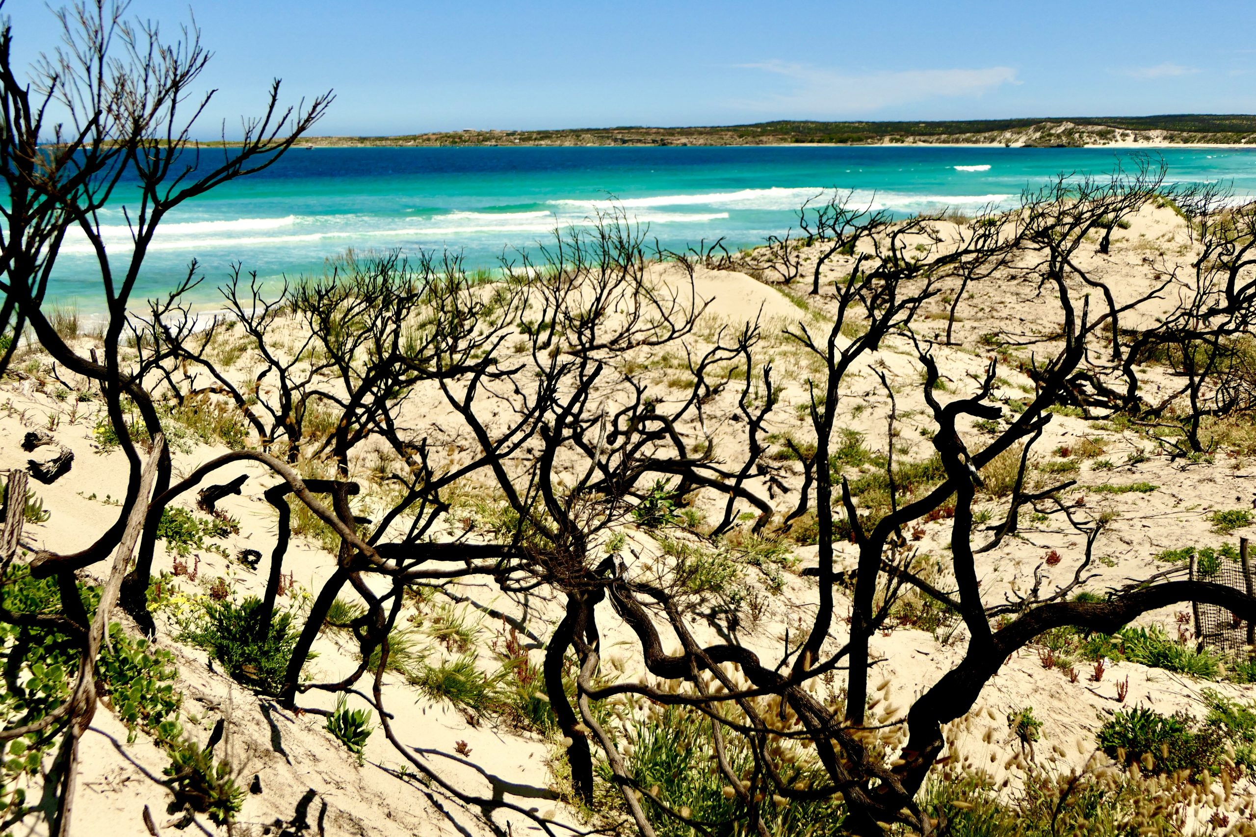
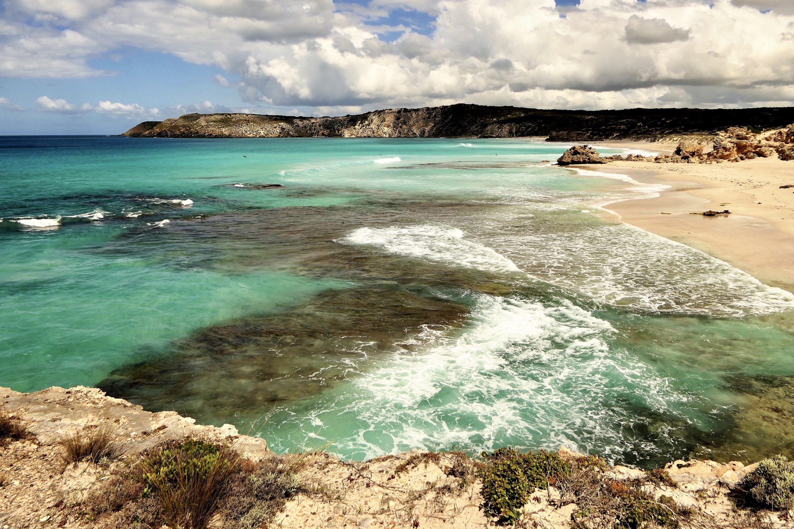
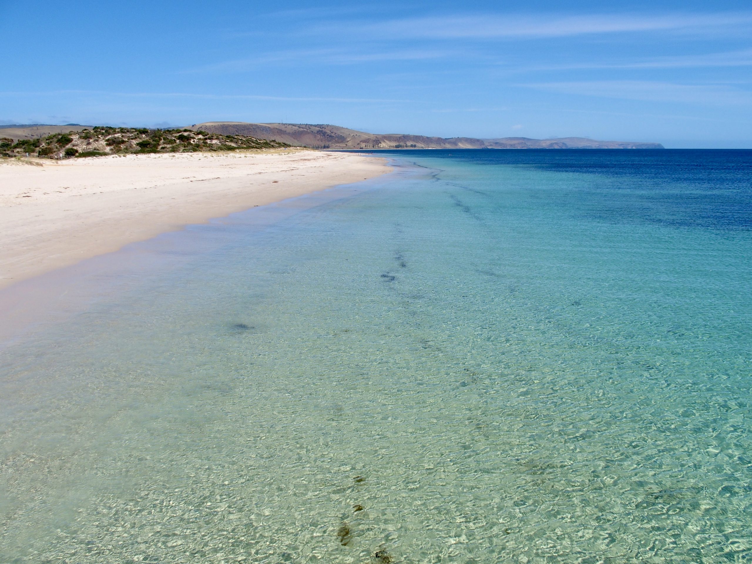
The island has become a land of dramatic contrasts. In the forest and farmland, the fire’s trail of destruction can end abruptly, leaving bare, burnt ground and untouched greenery side by side. Rocks, dunes and land formations are now strikingly bare where ground cover and the understory once hid them. In places, where the flames reached the sea, there is now an eerily beautiful juxtaposition of blackened vegetation against the island’s signature aquamarine waters.
Visiting the island now is not only a once-in-a-lifetime opportunity to witness its regeneration first hand, but also to assist community recovery by providing much needed cash flow to affected businesses and tourism operators.
Kangaroo Island, or “KI” (pronounced “kay-eye”) as it is known to locals, is Australia’s third-largest island after Tasmania and Melville Island.
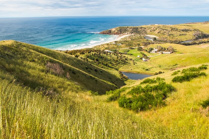
Travelling KI’s 155 kilometre (96 mi) length is a journey through a stunning wilderness landscape with 540 kilometres (335 mi) of rugged coastline. Explore untouched beaches and dune systems, rivers and lakes, lush forests and oddly-shaped rocky outcrops. Diverse animal and plant life, fresh regional produce and friendly locals all add to the relaxed island vibe. Despite the devastation of the fires, the attractions are all still here. A day or two will not be enough to experience everything the island has to offer.
How to get here
The fastest way to reach KI is a 30-minute flight from Adelaide, capital of the state of South Australia, to KI’s Kingscote Airport. Alternatively, take the ferry for a 45-minute ride across Backstairs Passage to KI’s Penneshaw, 22 kilometres (13.6 mi) from the closest mainland ferry terminal at Cape Jervis.

From Adelaide, it’s a 90-minute drive through the Fleurieu Peninsula to cover the 100 kilometres (62 mi) to Cape Jervis at its south-western tip. Driving from Adelaide gives the option of taking your own vehicle on the ferry, recommended for those who wish to explore the entire island. Caravans, camper trailers and campers can also be taken on the ferry, although tours are available for those without transportation.
My travelling companions and I decided to drive from Adelaide and first explore parts of the Fleurieu Peninsula’s western coastline en route to the Cape Jervis wharf. As we only had a few hours before our ferry departed, a full exploration of the peninsula’s stunning coastline and picturesque inland region wouldn’t be possible.
Instead, we chose a cross-section of attractions, including Port Noarlunga’s long jetty and red rocky walls above the Onkaparinga River mouth; the rolling vales and dramatic cliffs sweeping down to the sands of Sellicks Beach; the memorial to Australia’s only saint, Mary McKillop, in the Yankalilla township; the clear blue waters of Normanville beach; and Second Valley’s unusual coastal rock formations.
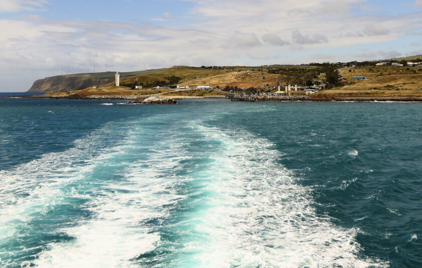
Backstairs Passage, the strait between Cape Jervis and Penneshaw, is known for its rough seas so choosing the best time to cross can be like picking a winning lottery ticket. According to ferry staff, our afternoon crossing was a rough one, but not as bad as the morning trip when most of a large school excursion group became violently sea-sick.
A turbulent crossing isn’t always bad news though. For us birdwatchers, heavy seas can mean a greater chance of spotting ocean-going birds such as shearwaters, petrels and albatross, not usually seen this close to land. The only trick is to stay upright on deck and hold the binoculars steady as the ferry heaves and rolls through the waves and cross-currents.
Kangaroo Island History
Discovery of stone tools, middens (ceremonial sites), campfire sites and cave shelters on KI are proof of Australian Indigenous occupation, thought to pre-date colonial settlement by up to 65,000 years. It is believed that a group of people remained on the island when rising waters separated it from the mainland 10,000 years ago during the last glacial period. Evidence also indicates they left the island 2,000 – 4,000 years before European colonisation, although it is unclear how or why.
Indigenous people from the mainland knew the island as Karta Pintingga or “Island of the dead”. This is because during the Aboriginal Dreamtime, the period in which life was created, a Spirit Ancestor travelled to the island en route to the Milky Way and was followed here by spirits of the dead seeking the afterlife.
There is some doubt as to when colonial exploration of KI began. The generally accepted version starts in 1802 when Matthew Flinders landed here while on an expedition to map Australia’s southern coastline for the British Government aboard HMS Investigator. He unimaginatively recorded it as “Kanguroo Island”, for its many kangaroos, a welcome source of fresh meat.
After leaving the island, the Investigator met French ship Le Geographe, captained by Nicolas Baudin. Although their countries were at war, the two captains exchanged information and later that year, Baudin mapped part of the KI coastline, giving many of its geographic features French names.
However, the discovery of an inscription on a tree in the Cygnet River locality dated 1800 and stating “The place for fat meat” indicates that the island was already known by then. To whom, and for how long is unknown.
Baudin’s crew later met some American sealers aboard the brig Union and passed on details of the island to them. The Americans had a quota of 12,000 seal skins, and so KI’s sealing industry began, closely followed by the arrival of whalers.
In 1836, the first free (non-convict) European settlement in Australia was established on KI by the British based South Australian Company. Faced with many difficulties, most of the colony relocated to the mainland four years later, leaving behind a few settlers whose tenacity and ingenuity in surviving harsh conditions are characteristics still evident in the present-day KI community.
Nowadays, KI produce is renowned for its quality and exported around the world. A variety of industries includes honey from the purest strain of Ligurian bees in the world; boutique wineries, breweries and a distillery; aquaculture and seafood; eucalyptus oil, lavender and olive products; oats and other cereal crops; along with livestock, sea salt, free range eggs and beauty products, all available from local outlets and shopfronts.
Penneshaw and the Dudley Peninsula
The ferry docks at the small town of Penneshaw, located at the island’s eastern end, a good base for exploring the Dudley Peninsula. Untouched by the fires, the peninsula’s natural attractions are a good introduction to life on KI.
We spent a day exploring the three conservation parks along the Dudley Peninsula’s south-eastern coastline. From mid-May to late October, southern right whales and the occasional humpback whale can be seen from the cliff tops along this section of the coast. Blue whales, the world’s largest animal, can also be seen from the shores, although they are more likely to be found feeding in upwelling zones further offshore, where nutrient-rich cold water rises from the ocean depths.
Baudin Conservation Park, with its coastal hiking trails and historic sites, is only two kilometres (1.24 mi) south-east of Penneshaw, not to be confused with Baudin Beach to the south-west.
Lashmar Conservation Park, halfway between Penneshaw and Cape Willoughby, is noted for its fishing, swimming, birdwatching and canoeing. There’s a popular camping area where the Chapman River, which flows through the park, enters the ocean at Antechamber Bay, with its beautiful sandy beach.
At KI’s easternmost point is the isolated Cape Willoughby lighthouse outpost, where South Australia’s first lighthouse was built in 1852. The lighthouse, attached museum and walking trails around the cape are now part of the Cape Willoughby conservation park.
Back in Penneshaw, watch the sunset over Christmas Cove. Then take an evening tour to see little penguins (Eudyptula minor) coming ashore on the beaches and cliffs after a day feeding out at sea.
Hog Bay Road follows a string of beaches, including Baudin Beach, south-west from Penneshaw to Prospect Hill, right on the peninsula’s narrow neck where it adjoins the central and western parts of the island. Follow in Matthew Flinders’ footsteps and climb the large sand dune, KI’s highest point, for 360 degree views north across Pelican Lagoon to American River and south to Pennington Bay. These days, a 350-step staircase makes the steep climb easier while protecting the fragile dunes beneath.
American River
From Prospect Hill it’s a 10 kilometre (6 mi) drive north to the small settlement of American River. After staying in Penneshaw overnight, we moved here for the remainder of our stay as it offers easier access to the rest of KI’s attractions.

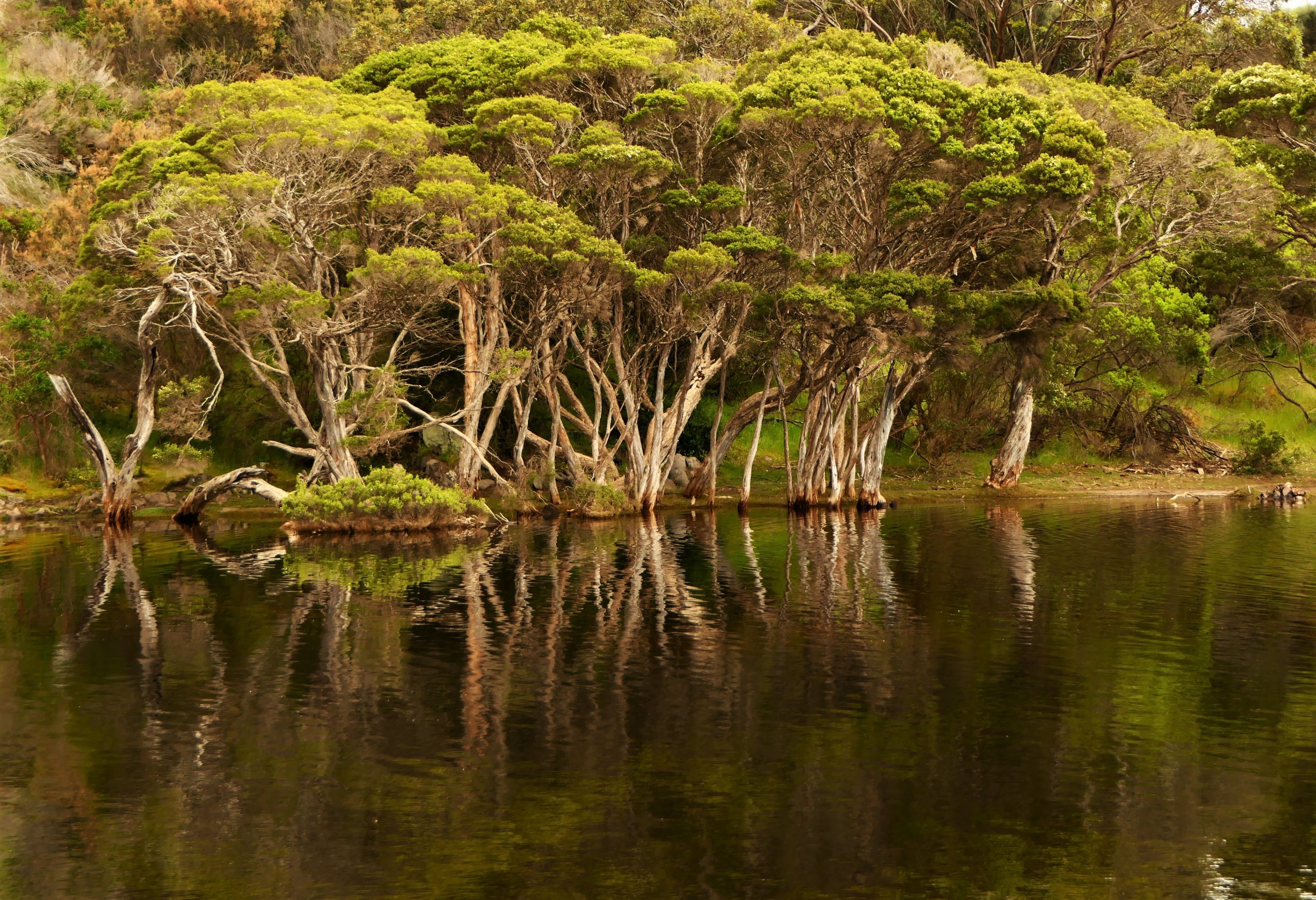
The locality was named in true Aussie style for a group of American sealers who camped on the shores of Pelican Lagoon, an ocean inlet which they mistakenly thought was a river. Sunrise over the inlet can be spectacular, with black swans (Cygnus atratus) and other water birds plentiful.
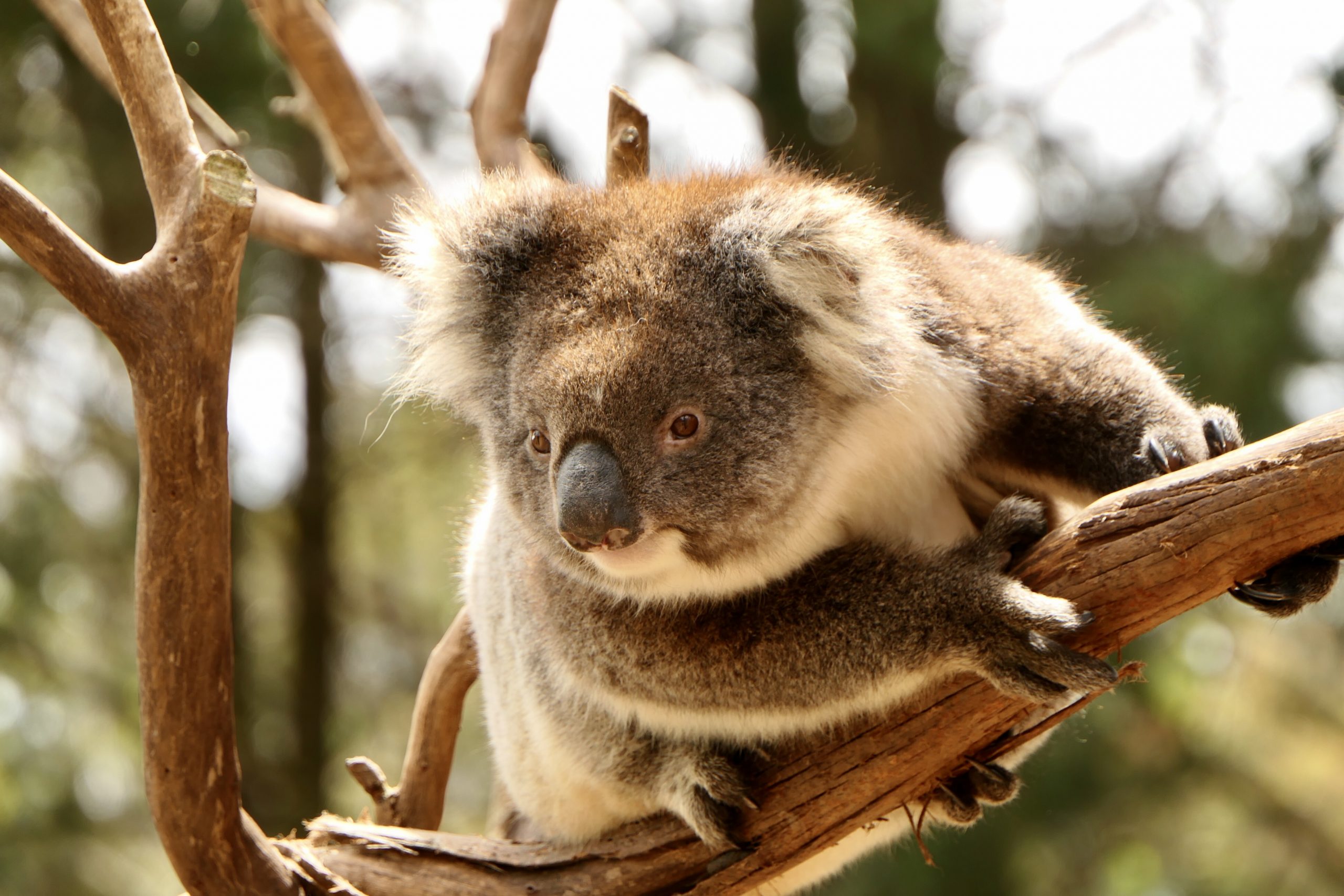
“Every morning I’d be given a koala to nurse for the day,” Kylie, an accommodation host based in American River, told me. “The next morning I’d be told that the koala I’d been looking after had died during the night. It was heartbreaking.” She and her husband had only lived on the island a short time before the fires, and even though the American River community wasn’t directly under threat, the smoke was so thick they thought they’d have to leave. They and their neighbours spent some tense nights watching the glow in the sky and hearing horror stories about what was happening at the other end of the island.
Once the fires raged out of control and all visitors had returned to the mainland, Kylie volunteered to help out at the wildlife rescue centre, set up to care for the influx of injured animals rescued by locals and firefighters.
 While exact pre- and post-bushfire numbers are unknown, it is believed that 80% of the estimated 50,000 koalas on KI perished. About 40% of those treated in the centre were rehabilitated to be released back into the wild, thanks to the tireless work of volunteers and donations from around the world.
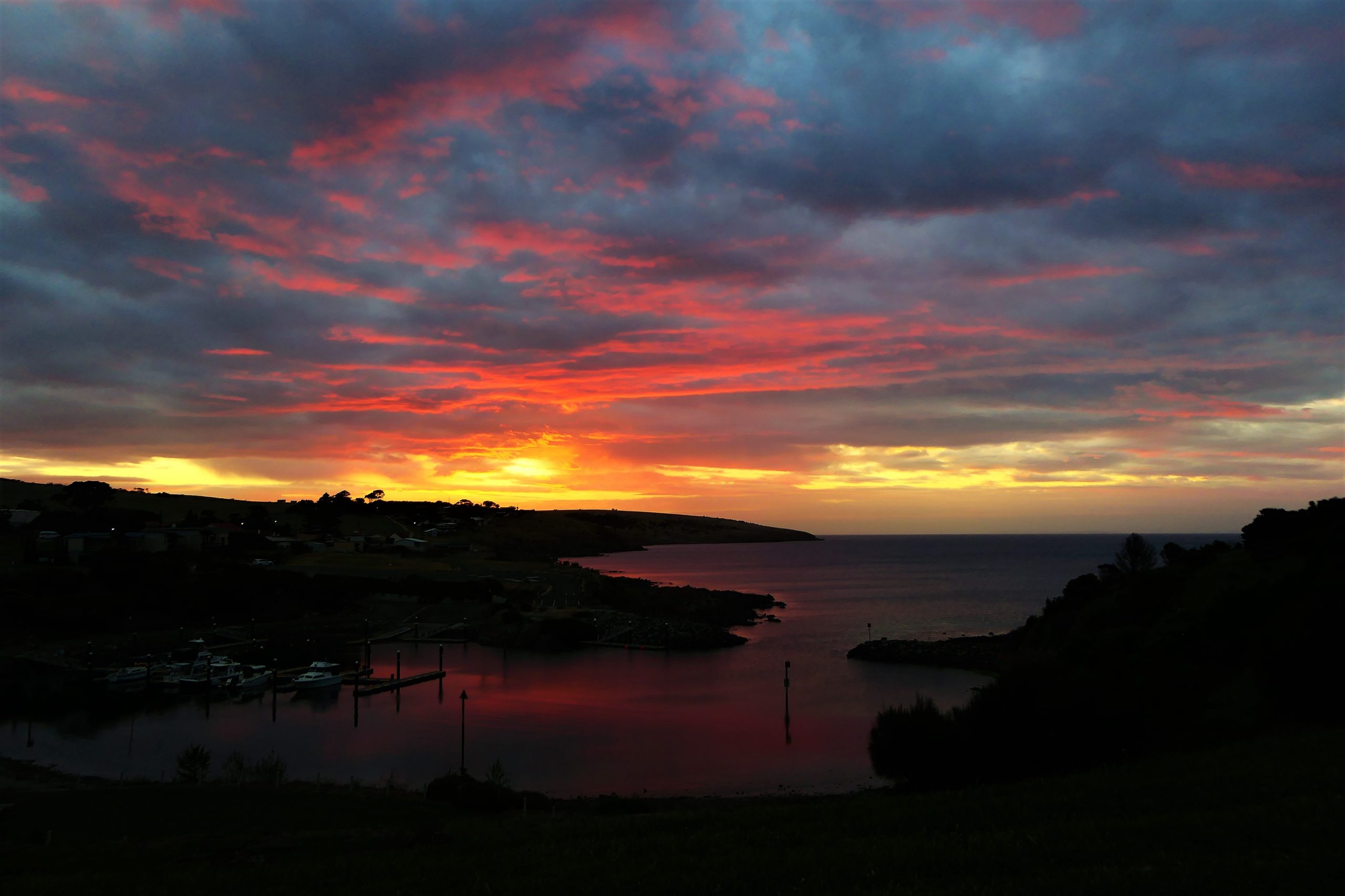
The Mercure Kangaroo Island Lodge where I was a guest, is located right across the road from the American River inlet. With comfortable and well-appointed rooms, an excellent restaurant and friendly, helpful staff, it’s also a good base from which to explore other parts of the island. Don’t miss sunrise over the inlet—the colours, reflections and waterbird silhouettes can be stunning. Afterwards, treat yourself to the wonderful breakfast buffet in the restaurant.
Famous for its seafood, American River’s most well known (and possibly most visited) attraction is the Oyster Farm Shop. It offers a daily selection of fresh seafood including local oysters, abalini (baby abalone), marron (freshwater crayfish), King George whiting and calamari.

Just outside town a hiking trail leads to the remains of the town’s historic fish cannery, established around 1890, but abandoned two years later as there was no way to store and keep excess fish. A short drive north-west of town is Redbanks, where multi-coloured cliffs tower above the beach.
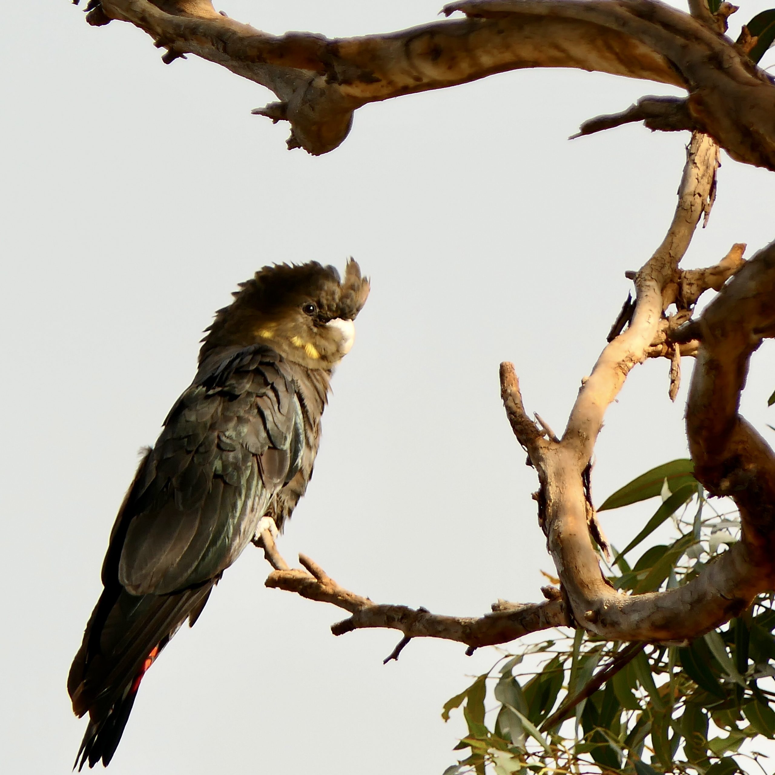
KI is home to an endemic subspecies of the critically endangered glossy black cockatoo (Calyptorhynchus lathami halmaturinus), and the American River flock can often be seen around the town and nearby bushland.
Kingscote and North Coast
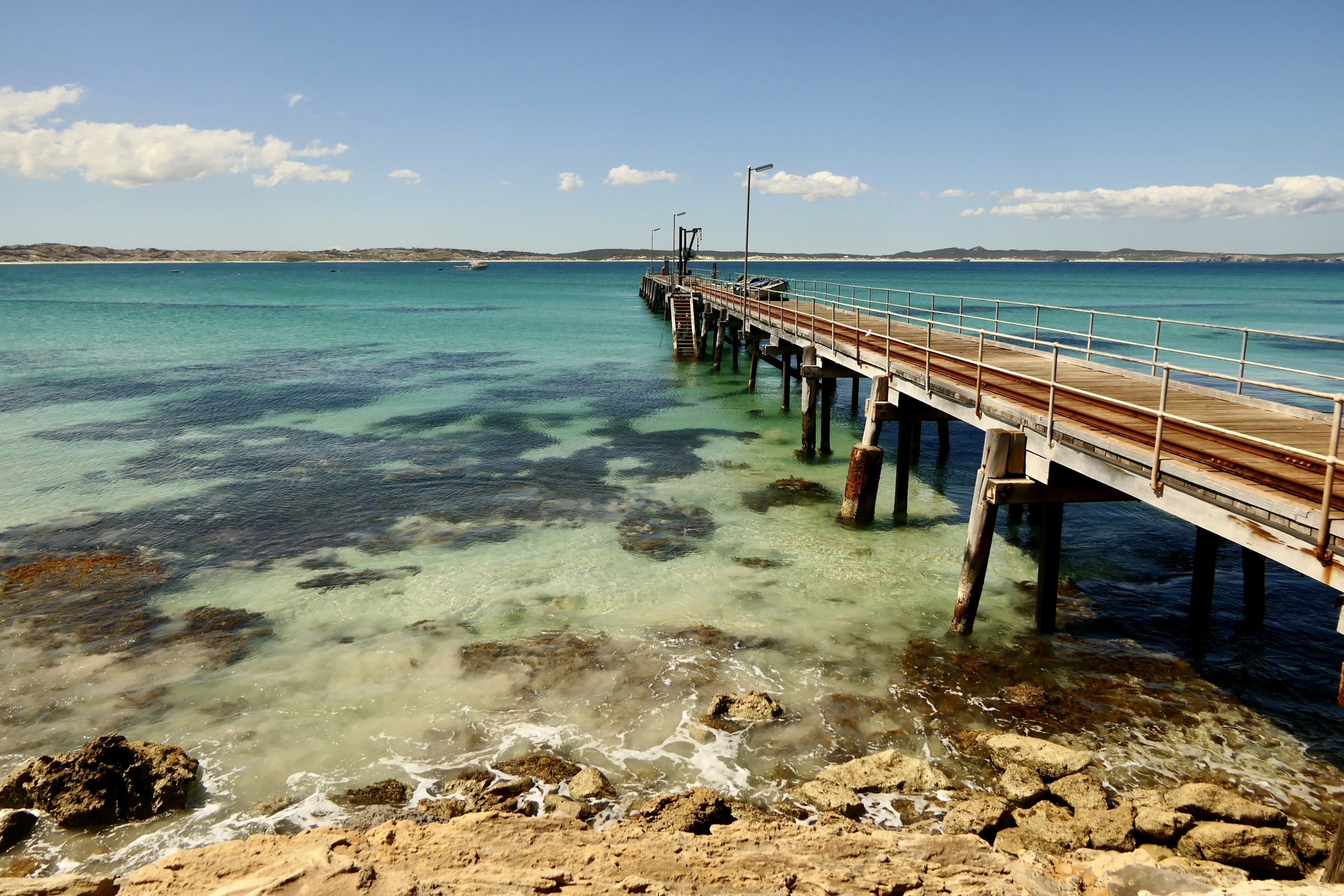
Kingscote, located 38 kilometres (24 mi) north-west of American River, is KI’s largest town and commercial centre. The first free Australian settlement was set up at nearby Reeves Point, now a reserve with walking trails and historic sites listed on the South Australian Heritage Register. The Nepean Bay jetty is a well known fishing spot, and great for sunrise or sunset shots. Look for sea lions and dolphins in the waters, and if you are lucky, you may see a koala wandering Kingscote’s main street.
 Explore the north coast’s secluded beaches from here, including the white sands of Emu Bay; the rocky portal leading to Stokes Bay; and the superb swimming and fishing at Snelling Beach. Parts of this region were hit hard by the bushfires, but much of the north-coast, especially the eastern end, is now accessible.
Snellings View, where I was a guest, makes an excellent base from which to discover the delights of the North Coast’s stunning coastal scenery—or just hide away and relax. With magnificent views over Snellings beach and the surrounding farmland from the deck, the open-plan lounge/dining area and both double bedrooms, this luxurious getaway is fully self-contained. Photos from a book produced by the owners show that the bushfires burned right up to the deck.
“I was wearing my mother’s engagement ring and a ring belonging to my late sister that day. My other jewellery and belongings were obliterated in the fire,” Priscilla, a north-coast local told me, describing the devastating losses the day that she and her partner lost their home.
“A year later, I’m still discovering things I didn’t realise were gone, and I feel the loss all over again. Luckily I had uploaded a lot of photos to Facebook because my hard drive and backup were destroyed.” The displacement of living in temporary accommodation without a permanent home to which they can return isn’t easy either.
Priscilla and her partner are now rebuilding, but the process is hampered by the logistics of living on an island. Returning to normal life is still a long way off but the support of the KI community, all of whom have been affected in some way by the fires, has been invaluable.
The South Coast
The South Coast road is known for its nature- and adventure-based attractions. Although the fire reached the sea here, the stunning colours, white sandy beaches and rock pools of Vivonne Bay make it easy to see why this beach was declared best in the world in 2003, and is arguably KI’s best beach location. Spend a day swimming, surfing, snorkelling, fishing, hiking or canoeing the Harriet River which meets the sea at the bay.
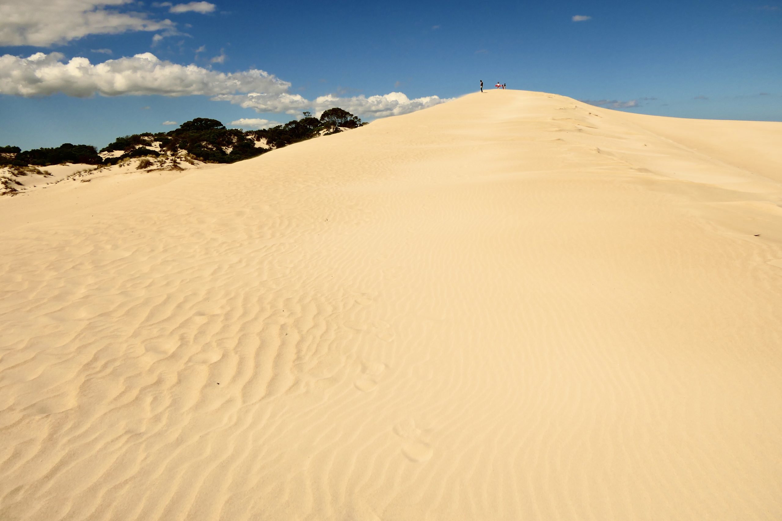
Nearby is Little Sahara, a coastal dune system popular for sandboarding and tobogganing. Sand buggies, quad bikes or fat bikes are also on offer by tour companies, with guided walking tours and kayaking also available.
Further east, the Seal Bay Conservation Park’s Australian sea lion colony can be observed from the Visitor Centre viewing platforms. Take a self-guided boardwalk tour, or get even closer on a guided tour.
Flinders Chase National Park
From American River, we took the 105 kilometre (66 mi) drive south-west to the Flinders Chase National Park entrance, taking about 75 minutes. En route, the fire damage became progressively worse until we reached the Bunker Hill lookout mentioned above, where the worst effects of the fire can be seen.
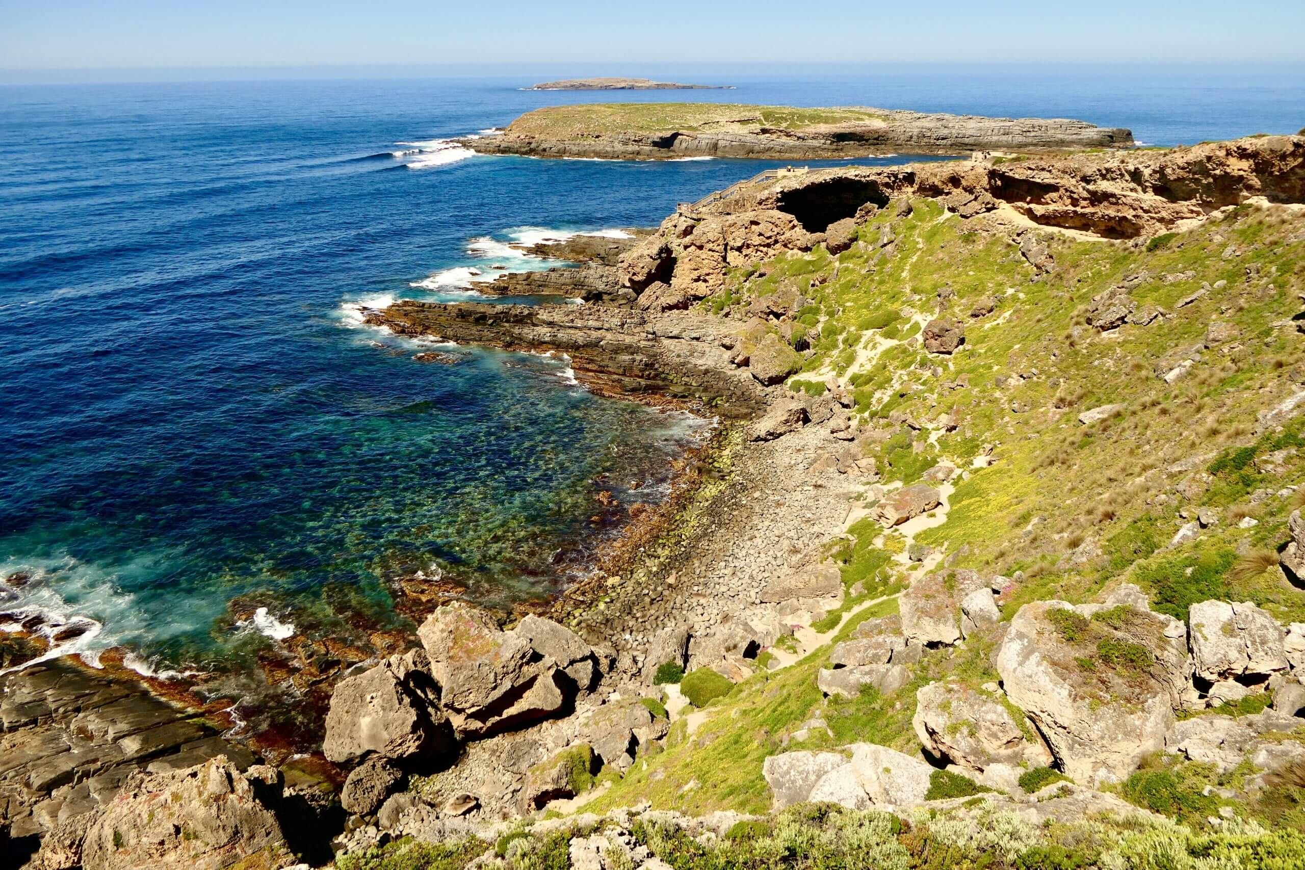
In the far south-west at Cape du Couedic, the low coastal vegetation is intact, a stark contrast with other coastal sections of the park now blackened and burnt. The Kangaroo Island Wilderness Trail, a five day trek passing through here, was badly damaged by the fires, but a modified version is now open. It is a rare opportunity to see bushland regeneration firsthand and view open landscapes not previously visible when covered by dense vegetation. Guided bushfire tours are also available.
Seals and other Wildlife
From the cape, a boardwalk descends into the cavernous Admirals Arch, a haven for the 7,000-strong long-nosed fur seal (Arctocephalus forsteri) colony living and breeding on the cape and Casuarina islets. By the 1880s, fur seals had been hunted almost to extinction for their thick, water repellent pelts. From 1900, various levels of protection have applied to the islets, and now the Western Kangaroo Island Marine Parks protect the waters these seals call home.

Wildlife is returning to the bushfire zone, although much of the habitat they relied on for food and shelter was destroyed. Rosenberg’s goanna (Varanus rosenbergi), a large monitor lizard, and the KI subspecies of short-beaked echidna (Tachyglossus aculeatus multiaculeatus) are able to bury themselves underground during bushfires in order to survive.
Weirs Cove
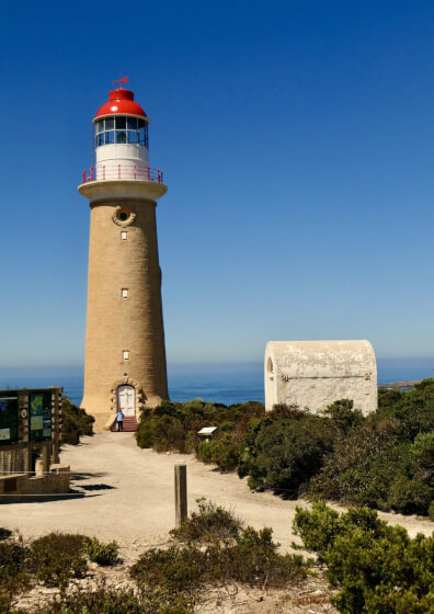
KI’s treacherous coastline and unpredictable waters have been responsible for over 80 shipwrecks. After lighthouses were built at Cape Willoughby and Cape Borda, the Cape du Couedic lighthouse was completed in 1909 after five ships and 79 lives were lost in the surrounding waters. Before road access to the cape, all lighthouse supplies—and visitors—were hoisted from the nearby Weirs Cove landing up a 92 metre (300 ft) high sheer cliff face to the settlement via a primitive “flying fox” winching system made of pulleys and ropes.

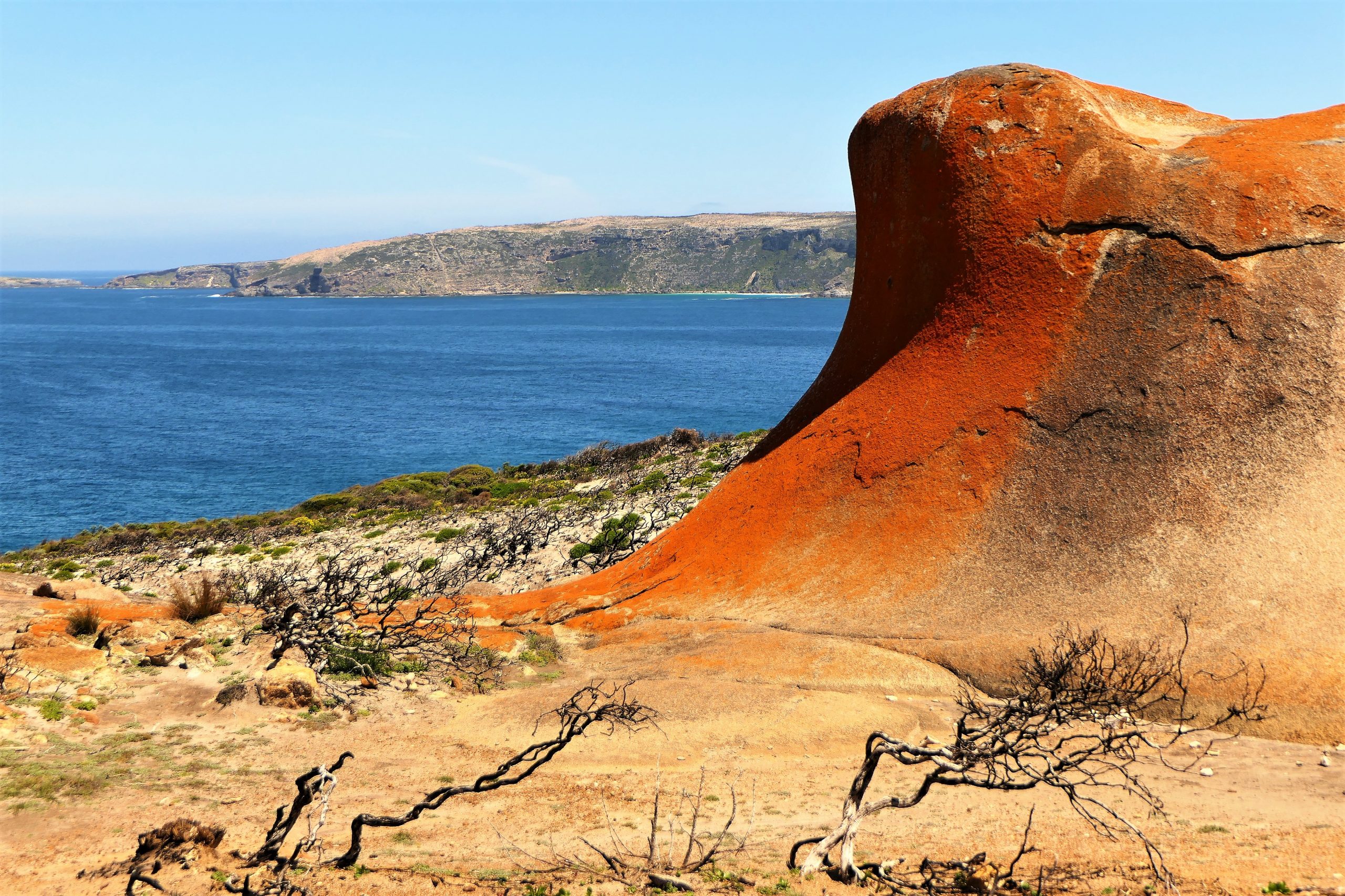
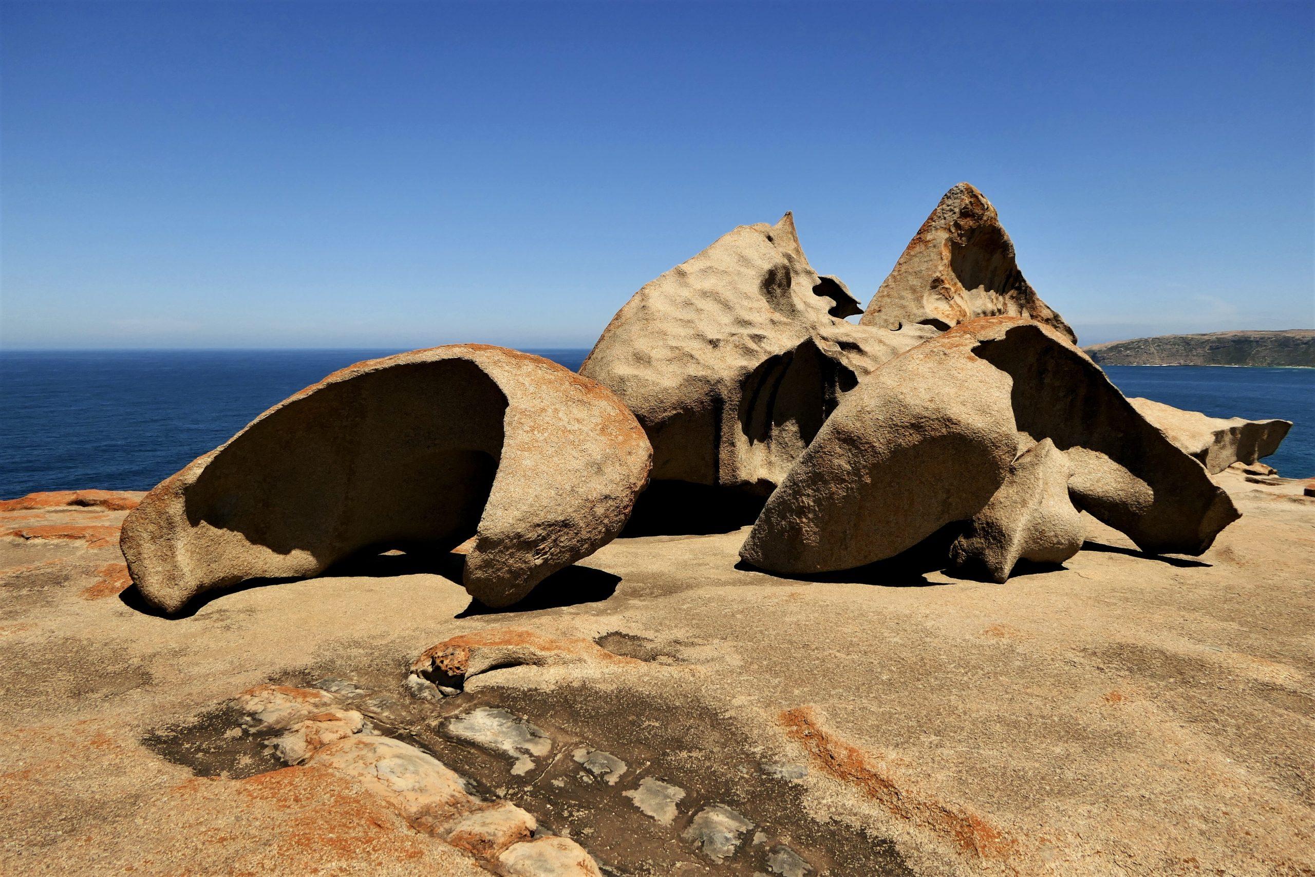
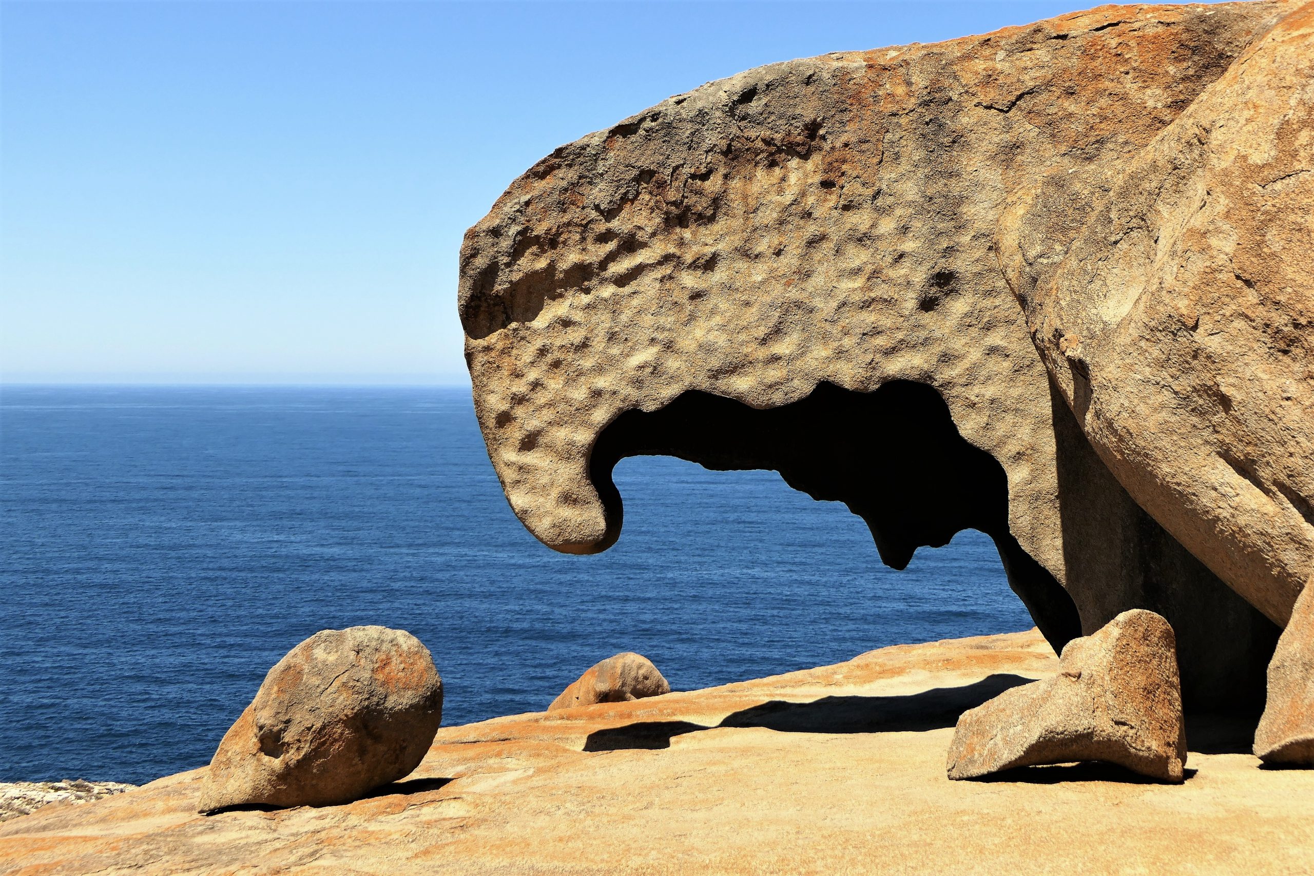
Remarkable Rocks
Ironically, no vegetation obscures the park’s most well known feature—the Remarkable Rocks—thanks to the bushfires. The tumbling pile of fractured granite blocks, weathered over millennia, sits on a large dome of exposed granite above a sheer cliff, clearly visible from Weirs Cove and the coast-hugging road. A coating of bright orange lichen renders some of the rocks even more bizarre.
Featuring in films such as “Napoleon” (1995), and “The December Boys” (2007), the rocks have also starred in countless home movies and social media posts. Many visitors have their photo taken under the “Turtle Beak”, a piece of hollowed-out rock shaped like a hooked finger dangling above the rocky base. Exploring the odd shapes and textures of the rocks can take a while if you’ve got a camera, and watching other people exploring the rocks can take even longer.
Although these were the only park attractions open to the public during our stay, I wasn’t disappointed. Seeing the park’s recovery firsthand replaced the despair I had felt when watching the horrifying blaze on the news night after night. I’m already looking forward to returning once more attractions have reopened.
Come to Kangaroo Island
Indisputably, the close-knit KI community is known for its resilience and courage, and for working together to preserve and protect the island they love. After seeing the beauty that remains and regeneration in the bushfire zone, it is even more apparent that this island is a special place.
While full recovery may take many more years, don’t leave it too long to experience its wonders. Kangaroo Island’s attractions await!
Want MORE?
- More about Kangaroo Island HERE
- More about the Fleurieu Peninsula HERE
- The original version of this article first appeared in GlobeRovers Magazine July 2021. For more interesting travel stories check out GlobeRovers HERE.
Pin it for Later!
What a lovely and informative article! Great photos too! Thanks for sharing.
Thank you Peter! It’s easy to get good photos when the scenery is like this, and a pleasure to write about such a fab destination! I hope you get to see it for yourself one day 😀
Your first photo grabbed my attention and led me to your stunning photos, tragic at times, uplifting at others and beautifully composed and descriptive writing. My brother holidayed there a few years ago and he said he liked KI. It is not a place I’ve considered as a holiday destination but it looks like the perfect Australian island for a non summer holiday. Great work on your part, no doubt dashed off in five minutes.
Andrew! Welcome back … and thank you, you are WAY too kind. Would love to dash off a quick post in 5 minutes, but don’t think that has ever happened!! This post was originally an article in a magazine I write for regularly (check it out here: https://www.globerovers-magazine.com/globerovers-magazine-july-2021-thailand/). KI has a bit of everything and the post-bushfire landscape is fascinating, it’s SO worth considering as a holiday destination. I’m about to go there again, will be interesting to see what’s changed!