Last Updated on January 23, 2022 by Red Nomad OZ

I suspected it when I first saw him in the distance. Then he slipped on his super-cool aviator sunnies* and I knew it for sure. Our pilot and tour guide for the flight over Lake Eyre was a dead ringer** for Freddie Mercury!
Of course looking like the Queen ex-frontman didn’t guarantee anything. But a top priority—not just for Freddie lookalikes but for ANY pilot—would be to keep yourself alive, wouldn’t it?
Good to know when you’re a nervous flyer waiting for the hammer to fall. Because during the four-hour tour, we’d fly over some of the most remote and inhospitable outback countryside in Australia!
The booking form had a field for total weight including the clothes you’d be wearing on the flight. I was tempted to lie, but figured I’d be outed as a fat-bottomed girl just by turning up. And besides, before Freddie (not his real name!) could make the 13-seater plane spread its wings and fly, he’d need to work a kind of magic and ensure it was properly balanced.
Easier said than done with a range of 13 different body sizes, shapes and weights to fit into super-narrow seats with super-constricting seat belts from which I knew I’d want to break free.
But even under pressure Freddie managed to play the game. He matched people to seats, made sure our headphones were fully operational, and hurtled down the runway before we could say “God save the Queen”.
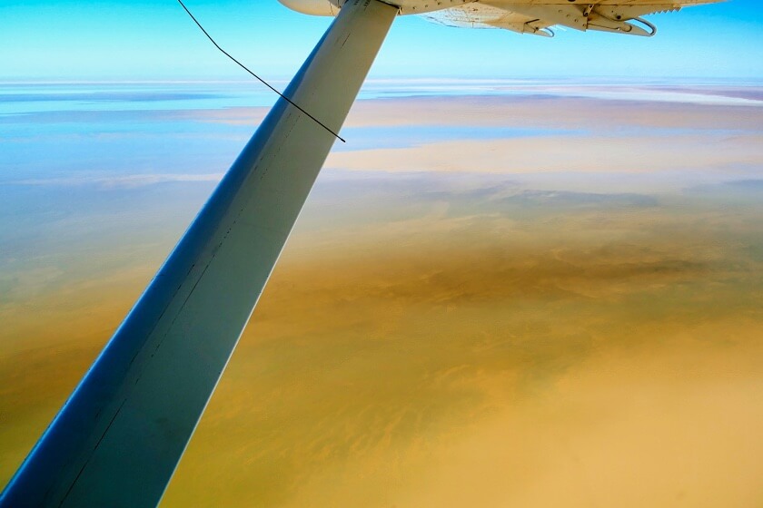
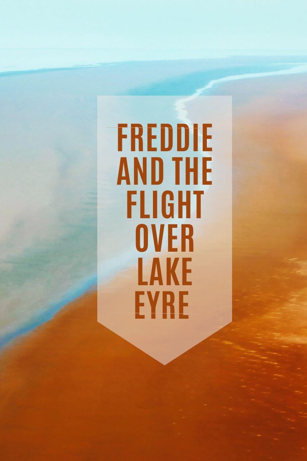
Leaving Coober Pedy
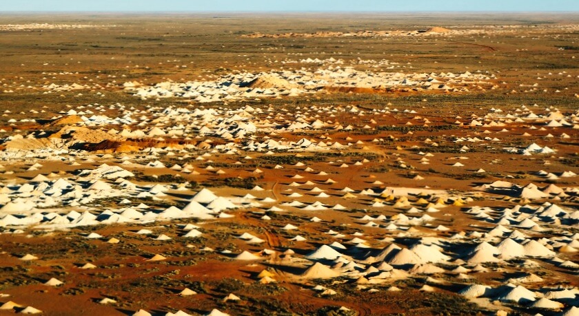
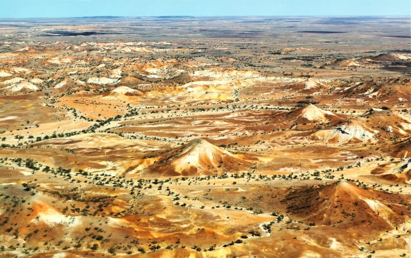
After leaving opal mining town Coober Pedy’s distinctive moonscape of mullock heaps*** behind, the first leg of the flight north-east to Lake Eyre North covered some spectacularly arid scenery. That was unsurprising given that the town’s rainfall for the year to date before this mid-June flight had totalled just 19.8 mm (0.8 inches).
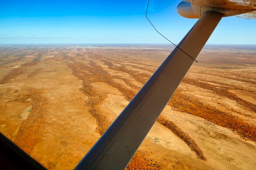
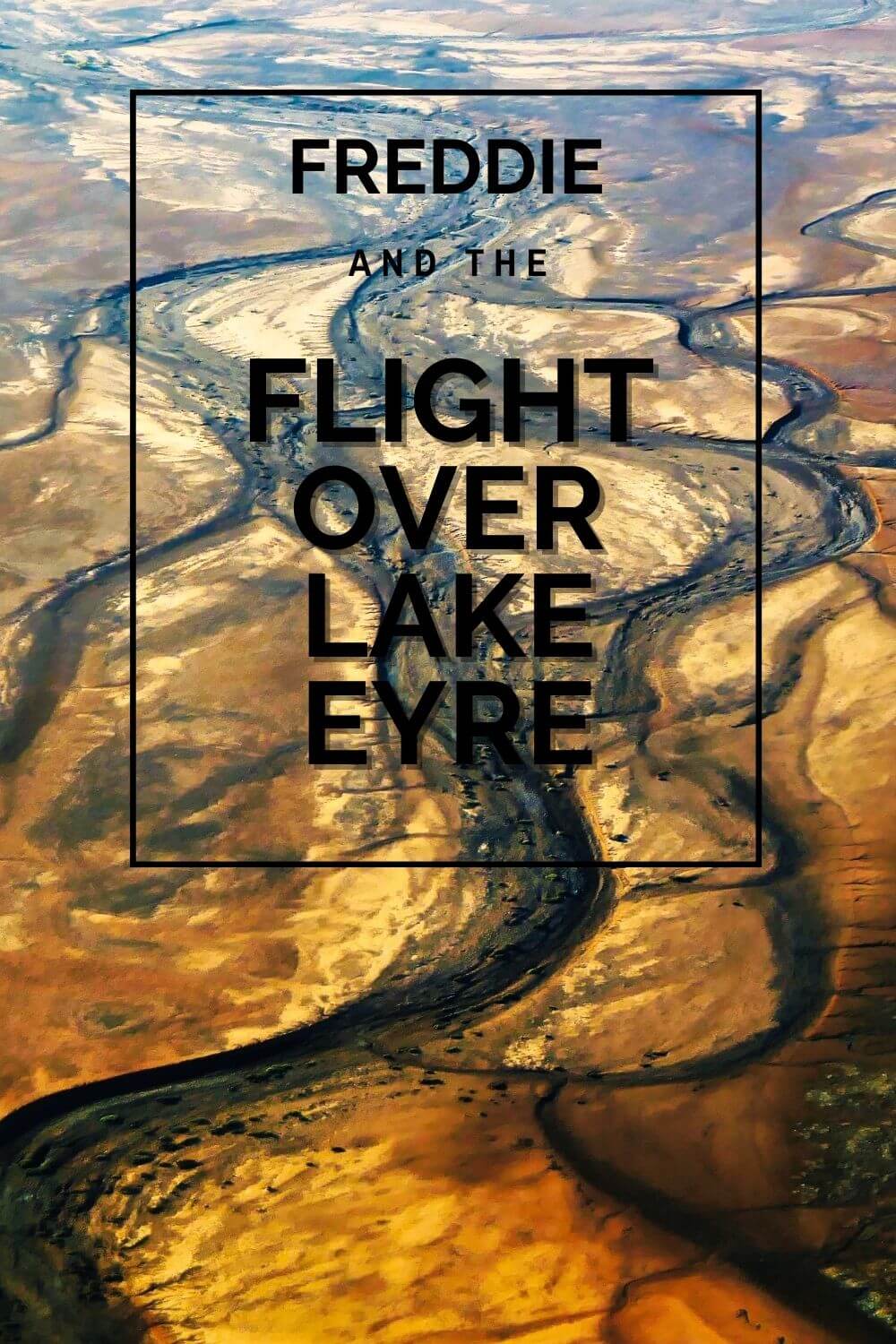
Rolling rocky ranges in the rich outback colour palette of ochres, reds and greens unfolded far beneath, and massive dry riverbeds cut feathery patterns into the sand and rock far below. Trees cast long shadows in the early morning light, and straight roads bisected the dry country below where occasional vehicles seemingly heading into oblivion traversed the endless landscape trailing powdery plumes. Out here in the harsh desert environment, being prepared could determine if another one bites the dust or not.
Although 1974 was the last time its area of 9,500 km² (3668 mi²) was filled to capacity, Kati Thanda-Lake Eyre is Australia’s largest salt lake, and one of the largest in the world.
It also has Australia’s lowest natural point at 15 metres (49 ft) below sea level. If flying over the lake wasn’t considered cheating, I could tick two more Aussie records off my list.
Kati Thanda-Lake Eyre
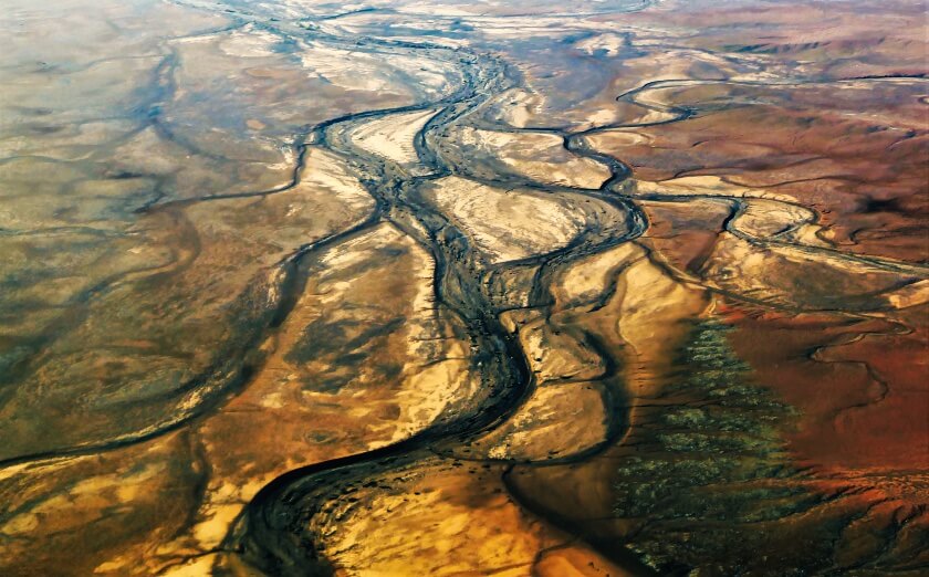
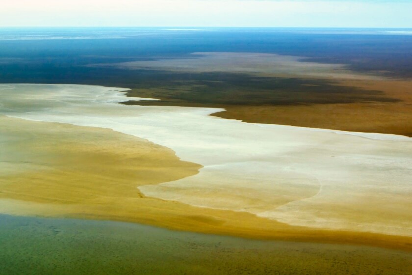
After two days experiencing Coober Pedy’s arid conditions and 90 minutes of flying over the dry and dusty desert we were completely unprepared for a volume of water so massive it merged with the horizon. Larger than life–just like Freddie’s namesake–but really to be expected out here where huge distances, huge landscapes and huge skies are just the norm. As my shutter-button finger went into overdrive, I felt this crazy little thing called love for the outback and its magnificent, but ever-changing panoramas.
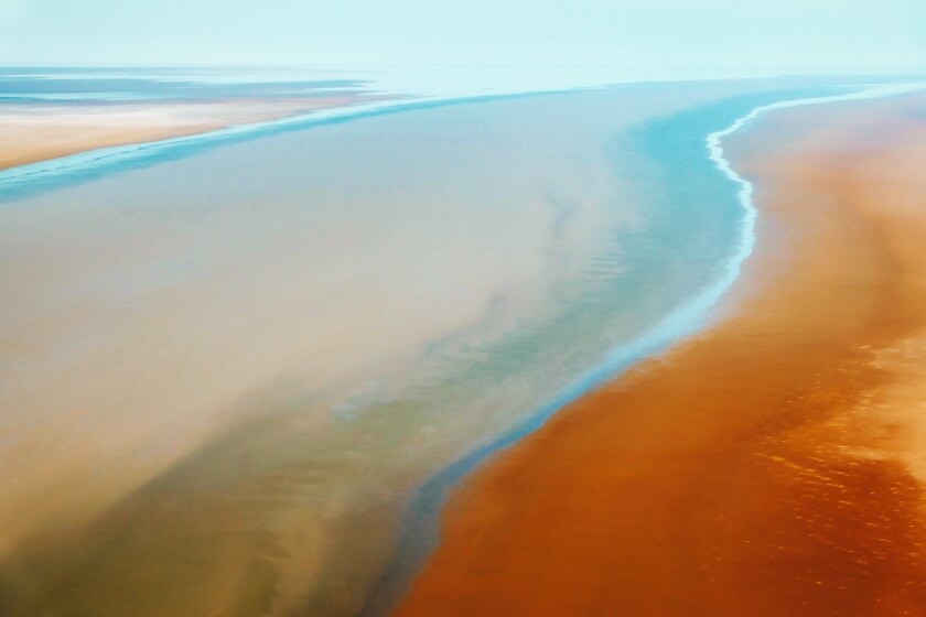
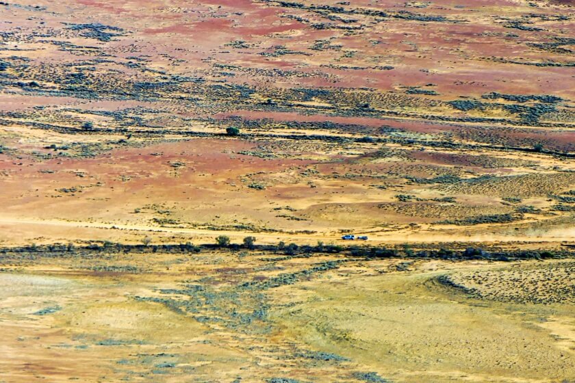
From Lake Eyre North, we flew south along the lake’s western edge where flocks of birds could occasionally be seen below. The salt-encrusted lake’s edge contrasted with the colours of the water in a breathtaking array of coloured lines and patterns and tiny vehicles came and went from the Halligan Bay Point camping area.

William Creek
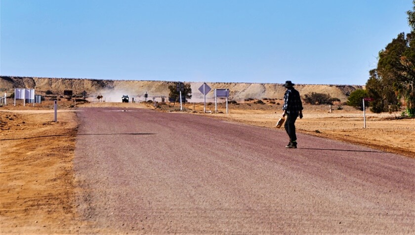
A short time later we were touching down in William Creek for morning tea at Australia’s most remote pub while the plane was being refuelled. The smallest town in Oz, closest town to Lake Eyre, and home of Wrightsair (our tour operator), its permanent population of three**** was outnumbered by the planes on the runway. Now that water from heavy rains in the northern catchment a few weeks earlier was flowing into Lake Eyre North, Wrightsair scenic tours, especially the flight over Lake Eyre were in hot demand and pilots from all over were working around the clock.
But the show must go on, so Freddie herded us back to the plane for the return flight west to Coober Pedy. Now nearly noon, the day was warming up and the flight over the little-known Anna Creek Painted Hills promised to be the ‘we will rock you’ leg. But who wants to live forever anyway?! The bumpy flight combined with the amount of morning tea some passengers had eaten was a killer combination. But no matter, Freddie had pointed out the on-board barf bags, which ensured it was heaven for everyone!
Anna Creek Station, 34 km (21 mi) from William Creek and 160 km (99 mi) east of Coober Pedy, is the largest working cattle station in the world and at 23,667 km² (9,142 mi²) in area, just a little bigger than Israel or El Salvador or Belize. Station land completely surrounds William Creek, and the property is also over seven times bigger than King Ranch in Texas, often cited as one of the largest in the world.
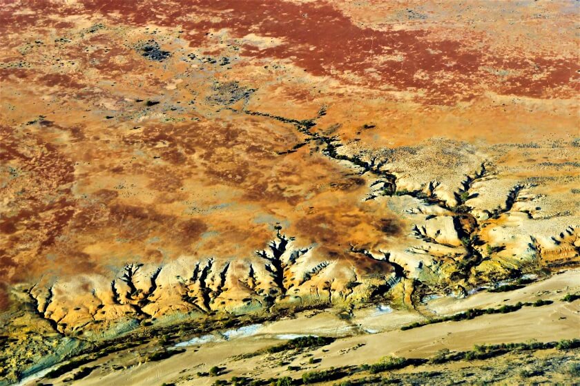
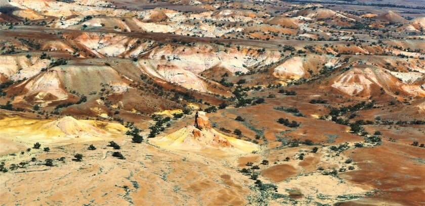
Anna Creek Painted Hills
The Anna Creek Painted Hills unfolded below in a symphony of colours and shapes. Only accessible by air and on a guided tour, I could see a lucky tour group exploring the area below and was consumed by jealousy. Was it so wrong to want it all? A few hundred (give or take) photos later, we left the hills behind—but I knew I was born to love them.
Then in a flash we were flying over the bohemian rhapsody that makes up the distinctive landscape of Coober Pedy’s mullock heaps***, mines, accommodation and rock formations again. With so many hazards on the ground, it was no bicycle race down there. Freddie’s flight radio was going ga-ga as we touched down. But as the plane taxied down the runway, I wanted to scream ‘don’t stop me now’, and turn around to do it all again. It’s a hard life.

Yes, the tour really is that good. Tie your mother down if that’ll get you on a Lake Eyre flight—although I can’t guarantee you’ll be piloted by fab Freddie, who, by the way, obligingly posed for photos once we’d disembarked.
Kati Thanda-Lake Eyre Flight Fast Facts:
Where to find it: Kati Thanda-Lake Eyre is 647 km (402 mi) north-east of Adelaide, and is part of the Kati Thanda-Lake Eyre National Park.
How to get there: Fly or drive to Coober Pedy, 850 km (528 mi) north-west of Adelaide. From Coober Pedy, it’s a further 166 km (103 mi) to William Creek. The lake is also accessible from Marree at the start of the Oodnadatta Track 655 km (407 mi) north of Adelaide.
Things to do: Experience the lake from above by taking a flight. We flew with Wrightsair, based in William Creek and flew from Coober Pedy with a stopover in William Creek. Flights are also available from Port Augusta, Marree, William Creek, Rawnsley Park (Flinders Ranges) and Parachilna (and some further afield) all of which offer accommodation, although availability should be checked before arrival.
On the ground, drive to the lake via the Oodnadatta Track from Coober Pedy/William Creek or Marree. Campgrounds are available in the National Park, and a Desert Parks Pass is required for access. Extreme care must be taken when travelling in the remote outback (see below for link).

When to go: Although it rarely fills to capacity, Lake Eyre has some water most years, but is most spectacular when flooded by outback rains. The Australian winter months of June to August are the most comfortable for outback travel.
Want MORE?
- Coober Pedy and William Creek, South Australia
- WrightsAir Scenic Flights
- Photos of Kati Thanda-Lake Eyre and Anna Creek Painted Hills
- Guide to Australian Outback Travel
* Sunnies = Australian for sunglasses
** Dead Ringer = Aussie slang for lookalike
*** Mullock Heap = a cone-shaped mound of loose stone left over from mining operations
**** According to the Wrightsair website
Pin for Later!
The aerial landscapes are superb!
Thank you! I loved taking these shots—it made me totally forget about being in a small plane and crashing to the ground 🙂
I didn’t know you were still travelling and blogging, these photos are gorgeous.
Hey River! As you can see, I don’t blog as frequently as I used to. But I’m still here!!
Thanks RedzAustralia for providing valuble information regarding Flights over lake eyre coober pedy south australia with best imeges , keep post best articles regarding australian tourism
Awwwww … thanks John! Glad you liked it!
We have flown over Lake Eyre – from WIlliam Creek – twice – once when dry and once when there had been a lot of rain – 2019. Enjoyed both the flights immensly. Though it looks like you had many more fabulous views from the flight from Coober Pedy. Nothing like seeing the earth from a small plane. Happy & safe travels Red! Your posts are enjoyable and informative as always!
Awwwww … thank you Jill! It sure is a great flight from Coober Pedy—without all the bumps in the road between there and William Creek! Maybe we’ll catch up on the road somewhere 😀
Hiya Red! I’ve been reading through *very* old emails and decided to see if you’re still blogging. And you are! These photos are so breathtaking!! I would never have the courage to ride in that sort of plane, so I’m glad you did and got those incredible images.
Anyway, I’m not sure if you’ll even remember the blogging days from a decade ago, but I wanted to say hi and I’m so glad you’re still posting such beautiful photos.
Awwwww … of course I remember you, TriGirl! It has been a long time!!! Thank you so much for dropping by, I think I have upped my photo game since we last “spoke”!!! Catch up again soon, I hope 😀
i love this article, keep it up
Awesome! Thanks for dropping in 😀
Your photos are on the next level, very like this photo “Coober Pedy Mine from the Air, Outback South Australia”. by the way, may I know what camera you are using in taking these photos? Have a safe journey!
Awwww… thank you, adventurers! It’s a great place to take photos – on a good day the atmosphere is so clear and the light is perfect! I used a Panasonic Lumix DMC-FZ2500 to take all pix in this blog post, and I used Luminar AI to edit them.
Lavish photos and what an experience. Lake Eyre is quite fascinating. The only reason I fly is because, ‘but for ANY pilot—would be to keep yourself alive, wouldn’t it?’.
Hahaha, yes indeed Andrew … the experience is totally amazing! If they’re alive then I’m alive – win-win!!
Gorgeous!!!
Thanks Chris! Nice to hear from you again 😀